Roseville · CA
Stoneridge, Roseville: Neighborhood Guide
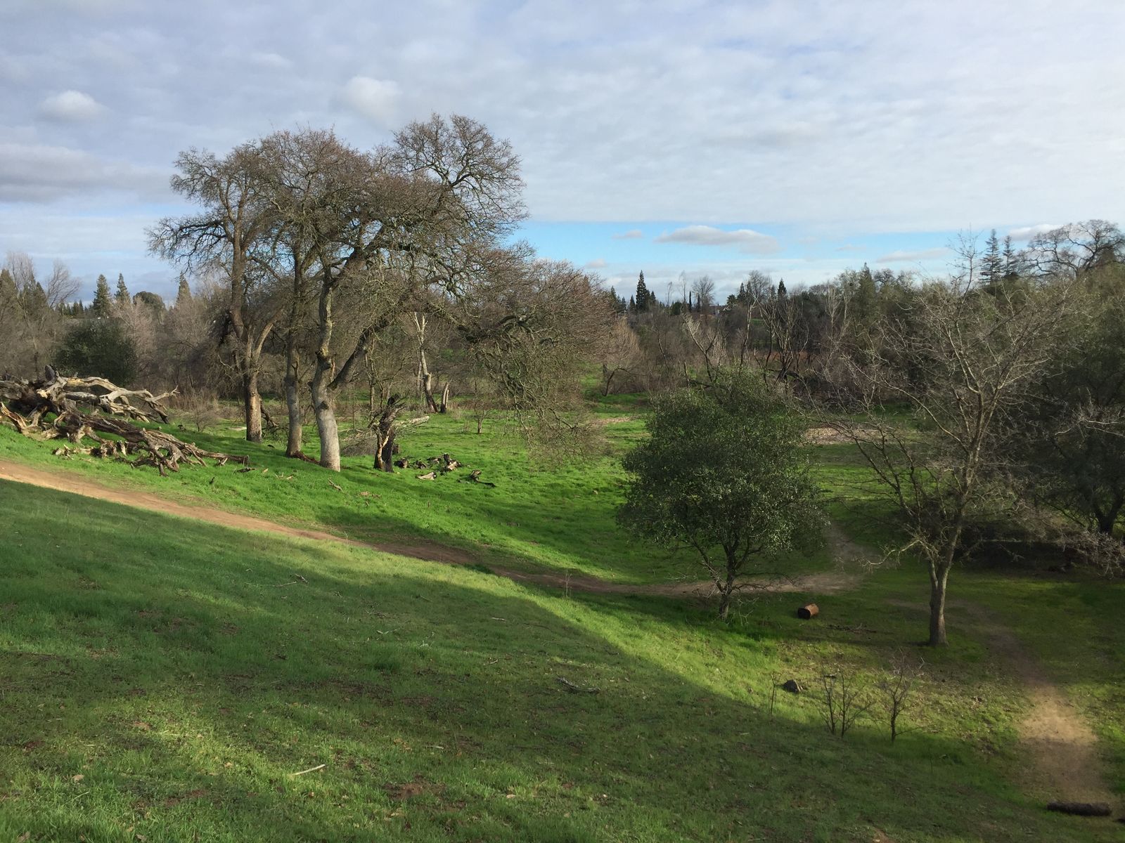
These are east Roseville homes on plateaus above Miners, False and Secret ravines, between Interstate 80 and Sierra College Boulevard.
What is Stoneridge?
Stoneridge is an east Roseville neighborhood built on high ground between three ravines. The City of Roseville adopted the Stoneridge Specific Plan in March 1998. The city's plan page gives it 1,117 acres and 2,861 single-family and multi-family homes.
Its borders follow roads and ravines. Rocklin sits to the north. Interstate 80, Secret Ravine and Roseville Parkway form the west edge. Olympus Drive runs along the south, and Sierra College Boulevard marks the east.
How did Stoneridge grow up?
About 699 acres had been held as urban reserve in the Northeast Roseville Specific Plan, according to the city. Another 390 acres were annexed from unincorporated Placer County. The 1998 plan joined them to finish the street grid on the city's east side.
The plan's big idea was to keep the ravines. Miners, False and Secret ravines were linked into one open space system, and homes were placed on the plateaus above them. The plan says that gives many streets views and paths into the open space. It also made room for a regional flood control detention basin.
The city lists development agreements with the Alexander Company, Elliott Homes, Guntert and Olympus Stoneridge.
What kind of homes are in Stoneridge?
Stoneridge is mostly detached single-family homes built after the 1998 plan, with more variety than a flat subdivision. Because the ground rises and falls, the plan allowed lots from ungraded custom sites to conventional lots, small single-family lots and half-plex lots on some corners. On sloped sites, yards and pads can step up or down from the street.
The plan sets aside about 78 acres of parks and 270 acres of open space, along with a fire station. Ask whether a home sits in a gated or HOA-run enclave, and read the CC&Rs before you write an offer.
How do you get around Stoneridge?
Roseville Parkway and Sierra College Boulevard carry most traffic. The plan built Roseville Parkway as a 100-foot arterial with a meandering 8-foot sidewalk behind a landscape strip. Sierra College Boulevard was widened to four lanes with bike lanes. Secret Ravine Parkway and Olympus Drive feed the streets inside.
Interstate 80 runs along the west edge. The Miners Ravine Trail reaches Sierra College Boulevard on the east side and follows the creek west toward downtown.
Which school district serves Stoneridge?
Stoneridge is in the Roseville Joint Union High School District for high school. East Roseville borders more than one elementary district, including the Roseville City School District, so the elementary district depends on the address. Confirm the assigned school with the district directly.
What draws buyers to Stoneridge?
Stoneridge offers ravine views, trails close by and a short trip to work. The plan was written partly to put homes near jobs in the Northeast Roseville plan and at Sutter Roseville Medical Center. In 2023 Sutter Roseville employed about 5,080 people and Kaiser Permanente about 5,760 in Roseville, per Wikipedia.
Shopping is close too. The Fountains, at 1182 Roseville Parkway, and the Galleria sit west across Interstate 80. Buyers comparing east and west Roseville often weigh Stoneridge against Highland Reserve North for that reason.
What should sellers in Stoneridge know?
Slopes need explaining. A buyer will ask about drainage, retaining walls and any soil work, so gather what you have. If a wall was repaired or a drain was added, the paperwork belongs in the disclosure packet.
Open space is your best photo. A home that backs onto a ravine should show it in daylight, with the path and the view. Price against homes with similar lots, since a view lot and a street-side lot on the same block can sell far apart.
The ravines also carry storm water. The plan made room for a regional flood control detention basin, and lots that back onto open space can sit near a mapped flood zone. Pull the flood map for the address so the buyer's lender is not the first to raise it.
Ready to talk about Stoneridge?
Surroundings can price a Stoneridge view lot and plan your next move in one conversation. Read selling your home in Roseville or downsizing in Roseville. Compare Highland Reserve North and Downtown and Old Town Roseville, or see the Roseville guide. Then talk with Maggie.
Frequently Asked Questions
Where is Stoneridge in Roseville?
Stoneridge is in east Roseville, between Interstate 80 and Roseville Parkway on the west and Sierra College Boulevard on the east, with Olympus Drive to the south and Rocklin to the north.
When was Stoneridge built?
The City of Roseville adopted the Stoneridge Specific Plan in March 1998, and homes filled in after that.
How many homes are in Stoneridge?
The city's plan page lists 2,861 single-family and multi-family homes on 1,117 acres.
What are the ravines in Stoneridge?
Miners, False and Secret ravines run through the plan area. The specific plan preserved them as linked open space and placed homes on the plateaus above.
What school district serves Stoneridge?
Stoneridge is in the Roseville Joint Union High School District for high school. East Roseville borders more than one elementary district, including the Roseville City School District, so the elementary district depends on the address. Confirm the assigned school with the district directly.
How much open space is in Stoneridge?
The city's plan page lists about 270 acres of open space and 78 acres of parks.
Who developed Stoneridge?
The city lists development agreements with the Alexander Company, Elliott Homes, Guntert and Olympus Stoneridge. Those agreements show who held land under the plan, not which builder built each street.
The method
How we do it in Stoneridge
More of Roseville
Ready to make your move with Surroundings?