Sacramento County · CA
Sacramento Neighborhoods, From the Grid to the River Bend
The capital city: Midtown, East Sacramento, Land Park, Curtis Park, Natomas and the neighborhoods in between.
The Human Thomas Guide
Which Sacramento personality are you?
Take the Find Your Fit quiz: how you want your Saturday to feel, matched to neighborhoods with real prices.
Living in the City of Sacramento
Sacramento neighborhoods change every couple of miles. A Midtown Victorian on a lettered street, a 1950s Eichler in South Land Park Hills and a 2000s tract home in North Natomas all carry the same city address. They come with very different lots, commutes and questions.
The California Department of Finance counted 539,765 people in the City of Sacramento on January 1, 2026. That was up 1.3% from a year earlier and made it California's sixth largest city. The city was laid out in 1848 and incorporated in 1850, and the Legislature moved here for good in 1854.
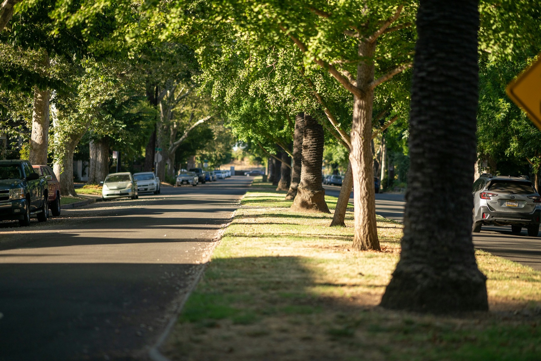
The city sits where the American River runs into the Sacramento River. In 1978 the Arbor Day Foundation named it the first "City of Trees" in the country. The city measures its tree canopy at about 19% today, and its Urban Forest Plan aims for 35% by 2045.
Inside the city limits you have state offices downtown, Sacramento State in East Sacramento and the airport about 10.5 miles northwest of downtown. Electricity comes from SMUD rather than PG&E, which still supplies gas. People coming from the Bay Area notice that on the first bill.
Talk With Maggie About Sacramento
How Surroundings Serves Sacramento
Surroundings is a Sacramento real estate and lending brokerage, and the city is home ground. Maggie B. Hopkins has held a California real estate license since 2006 and has 23 years in real estate and lending combined. She has owned Surroundings since 2023.
Our work in the city leans on a few specialties. Maggie is a Seniors Real Estate Specialist® (SRES®), a Certified Probate & Trust Specialist and a Certified VA Loan Specialist. A parent leaving a Pocket ranch house, an heir selling a Curtis Park bungalow or a veteran buying a first home each gets a plan built for that house and that person. We never take a placement fee from any community or care provider.
Real estate and mortgage brokerage sit under one roof here, if you want both. Maggie shops loans across a network of approved lenders, so the financing is competitive, and you are always free to bring your own lender. For sellers, that lending background means we can read a buyer's approval before you sign.
Rachel Dee Minyard, our REALTOR® and Creative Director, lists and sells homes and knows the city's streets block by block. She helps sellers price and position a home and decide what a buyer should see first.
Sacramento Neighborhoods and What Each One Is Built From
The clearest way to understand the city is by the decade each part was built.
- Midtown. Usually defined as J to R Streets and 16th to 30th Streets, Midtown is a tree-lined grid of old Victorians with infill lofts and apartments between them. Sutter's Fort, Second Saturday and the Saturday farmers market at 1050 20th Street are all inside it. The Boulevard Park and Newton Booth historic districts sit at its edges.
- Downtown. Golden 1 Center opened here in 2016, and the state offices that now ask most workers in four days a week are a short walk away. The Crocker Art Museum, founded in 1885, and the California State Railroad Museum in Old Sacramento anchor the riverfront.
- East Sacramento. Development began in the 1890s, and the area joined the city in 1911. The Fabulous Forties, 38th to 47th Streets between J Street and Folsom Boulevard, carry the largest lots. McKinley Park and Sacramento State bracket the neighborhood.
- Land Park. Land Park is mostly single-family streets between I-5 and Freeport Boulevard, wrapped around William Land Park. South Land Park Hills holds Eichler homes from 1955 and 1956, made a city historic district in 2024.
- Curtis Park. Curtis Park grew as Victorian, bungalow and 1920s revival subdivisions between Freeport Boulevard and Highway 99, from Broadway to Sutterville Road.
- Pocket and Greenhaven. This river bend began as the master-planned Greenhaven '70 in 1958 and filled in during the 1980s and early 1990s. Lake Greenhaven, a former brickyard clay pit, is ringed by private lakefront homes.
- Natomas. South Natomas was built mostly from the 1950s to the 1980s. North Natomas was farmland until the mid-1990s, and its subareas include Natomas Park, Westlake and Willowcreek. It also holds the city's two gated 55+ communities, covered on our downsizing in Sacramento page.
Sacramento Housing Market and Home Types
Redfin data reported by Stacker put the City of Sacramento's three-month average sale price at $573,333 for January through March 2026, down 1.6% from the same months of 2025. Inside the city, the spread around that number is wide.
Maggie's own MetroList pull shows how wide. In the Land Park ZIP codes, 95818 and 95822, 42 homes closed in September 2026 at a median of $609,000, or $418 a square foot. Across all of Sacramento County that month, 1,032 homes closed at a median of $545,000 and $327 a square foot. Land Park buyers paid about 28% more per square foot than the county as a whole.
The top of the city is tighter still. Homes above $1.5 million in East Sacramento and Midtown come up rarely, so we pull the current sales and listings before you decide.
Home types follow the map. Midtown and Downtown mix Victorians, flats, condos and lofts. East Sacramento, Land Park and Curtis Park are mostly prewar and midcentury single-family homes. The Pocket and Natomas carry the newer stock, from 1960s ranch homes to 2000s two-stories.
Farmers Markets, Ballgames and the River Trails
The city's biggest farmers market runs every Sunday morning year-round under the freeway at 8th and W Streets. Capitol Mall adds a Wednesday market from April to October, and Meadowview runs Sundays from May to October.
The Kitchen at 915 Broadway earned Sacramento's first Michelin star in 2019 and kept it in June 2026. Frank Fat's on L Street marked 87 years in 2026. The Torch Club on 15th Street has booked live blues since 1934, and Channel 24 opened in Midtown in April 2025 with room for 2,150.
Golfers have four city courses. Haggin Oaks has an Alister MacKenzie course that opened in 1932, and William Land's nine holes date to 1924. Bing Maloney and Bartley Cavanaugh sit on Freeport Boulevard.
The Sacramento Zoo has been in William Land Park since 1927. Its planned move to Elk Grove was cancelled in 2025, and an expansion at the park was approved in April 2026.
Choose Among Sacramento Neighborhoods With a Plan
Sacramento neighborhoods reward a buyer or seller who knows the street, not only the ZIP code. If you are buying, start with buying a home in Sacramento. If you are selling, see selling your home in Sacramento, or ask for a home valuation in Sacramento.
If you are weighing the suburbs too, compare Elk Grove to the south or the wider Sacramento County guide. When you are ready, talk with Maggie about the part of the city you have in mind.
Frequently Asked Questions
What are the main neighborhoods in the City of Sacramento?
The city's best-known neighborhoods include Midtown, Downtown, East Sacramento, Land Park, Curtis Park, the Pocket and Greenhaven, and Natomas. Arden-Arcade, Carmichael and Fair Oaks have Sacramento mailing addresses in places, but they are unincorporated county areas, not part of the city.
How many people live in the City of Sacramento?
The California Department of Finance estimated 539,765 residents on January 1, 2026. That was up 1.3% from a year earlier and made Sacramento the sixth largest city in California.
What does a home cost in the City of Sacramento?
Redfin data reported by Stacker put the city's average sale price at $573,333 for January through March 2026. Prices vary widely by neighborhood. MetroList data showed a September 2026 median of $609,000 in the Land Park ZIP codes alone.
What school district serves a Sacramento address?
Most of the city is in Sacramento City Unified School District. Most of Natomas is in Natomas Unified School District, and parts of the north and south fall in Twin Rivers Unified School District and Elk Grove Unified School District. Confirm the assigned school with the district directly.
Who provides electricity in Sacramento?
SMUD, the Sacramento Municipal Utility District, supplies electricity in the City of Sacramento. PG&E still supplies natural gas.
Neighborhoods in Sacramento
- East Sacramento
East Sacramento has prewar streets east of Midtown, from the large lots of the Fabulous Forties to the blocks around McKinley Park.
- Midtown
Midtown is the tree-lined street grid east of downtown, with Victorians, flats, lofts and the city's busiest blocks for food and music.
- Downtown Sacramento
Downtown Sacramento holds the Capitol, Old Sacramento and the Railyards, with condos, lofts and a few older homes inside the original grid.
- Land Park
Land Park has 1930s period revival homes wrapped around William Land Park, between I-5 and Freeport Boulevard.
- Curtis Park
Curtis Park has Victorians, bungalows and 1920s revival homes between Freeport Boulevard and Highway 99, plus the newer Crocker Village.
- South Land Park
South Land Park has midcentury homes south of Sutterville Road, including the 1955 and 1956 Eichlers of South Land Park Hills.
- Pocket-Greenhaven
Pocket-Greenhaven is a river-bend neighborhood south of downtown, planned from 1958 and filled in through the 1980s and early 1990s.
- Hollywood Park
Hollywood Park is a post-war neighborhood of about 600 homes between Freeport Boulevard and 24th Street, south of Sutterville Road.
- North Natomas
North Natomas is former farmland north of I-80, built out since the mid-1990s, with newer homes close to the airport and downtown.
- South Natomas
South Natomas has subdivisions from the 1950s to the 1980s between I-80 and the American River, minutes from downtown on I-5.
- Oak Park
Oak Park is Sacramento's first suburb, laid out in 1887 around an oak grove, with early bungalows and the Broadway Triangle.
- Tahoe Park
Tahoe Park has late-1930s and post-war homes south of U.S. 50, built around a 19-acre city park near Sac State and UC Davis Medical Center.
- River Park
River Park is a late-1940s and 1950s neighborhood inside a bend of the American River, reached by two entrances on H Street.
- Elmhurst
Elmhurst began as a 1908 subdivision south of U.S. 50 along T Street, next to UC Davis Medical Center.
Buying in Sacramento
The method
How we do it in Sacramento
Explore more of Sacramento
Ready to make your move with Surroundings?